Destination: Saufley's
Miles: 0
Adrian:
I feel better this morning! Amazing what water and a good night's sleep will do for you.
Today we take the Volvo, one of two cars and 5 bikes that they loan out to hikers for running errands. We'll go to REI, the grocery store and maybe even get a haircut. Because we are only 30 minutes from Northridge (L.A.), we have any store we could dream of needing.
When you arrive here Donna gives you loaner clothing and does your laundry. She then assigns you a cot or bedroom, or in our case the front cab of the horse trailer out behind the barn :)
The Saufley's house sits on about 3 acres. They have 2 horses and 7 dogs all of which have been rescued.
I met Tattoo Joe today. He holds the speed record for the PCT. He did the whole thing in 79 days. He's going for it again this year and starts in a couple weeks. I wished him luck and hope we see him on trail.
I also learned Rocketgirl is a made up hiker. She supposedly held the record but she's not real so...I'm bummed as she was my hero, just kidding but it is funny.
I also met Squatch, who made all the Walk series of PCT movies.
This is the epicenter of the PCT, no doubt. It's a lot of fun and the energy is high. Hikers come and go all the time, each highly motivated and after 450 miles, elite. We are among hiking giants from all over the world. It feels good.
Kirsten:
OK, Adrian lay off the sugar cereal. We ran errands today with Walt and another married couple Danger, that is his real middle name, and Wildflower. They are a pretty awesome young couple who are fast and motivated. We'd love to keep hiking with them. I think they'll blow by us soon.
So, the Saufley's. Where do I begin? The morning starts with Donna cleaning up her house, saying goodbye to hikers, feeding her dogs and horses. Then she cleans up the property, the rooms, the bathroom etc., all the while switching out laundry and welcoming hikers.
The atmosphere here has a relaxed energy about it. The Saufleys have been doing this for 12 years and they're not burned out. As Donna puts it "I'm just doing my thing."
It's hard for me to understand how they can give so much of themselves. Every time I think about I get overwhelmed. Have you given like this? Not necessarily house 30 hikers a day. And I don't mean writing a check to your alma mater or local charity. I'm talking about giving in a way that might mean sacrificing on your part. The kind of giving that will make your life a little more difficult at times.
I can't say I've ever met that standard. I think it's time I start practicing.
Speaking of trail angels, the Moore's drove to Saufley's today to visit hikers who stayed with them. Maria brought Mexican food. I have no words.
Saturday, May 31, 2008
May 28, 2008 Pacific Crest Trail
Destination: Aqua Dulce, Saufley's
Miles: 14
Adrian: Felt like crap this morning and only marginally better after hiking a while. I've also got some irritated bowel situation going on that isn't too pleasant.
Anyway, we hiked down to the Hwy 14 and Vasquez Rocks where they filmed Flintstones and various western movies. It reminded me of Red Rocks in Morrison, Colorado.

We reached the Saufley's and went out to a pizza joint where my appetite left me. I was barely able to ride the bike back up the hills to the house. Hopefully the next day will be better than the last.
Good night.
Kirsten:
We started out early this morning in an effort to beat the desert heat, which has been tame as of late, and to get to the Saufleys.

We reached Agua Dulce by 1 p.m. and immediately hit the local Mexican joint. I feel sorry for the people who have to deal with us as the stinky hiker trash that we've become. I've been tipping more than 20 percent to compensate for our nastiness.
OK, the best part. We started to walk to the Saufley's house and ended up getting a ride. When we walked through the gates - there are two to prevent their seven dogs from escaping - we were welcomed by Donna Saufley or L-Rod. She doesn't stop. Ever. Never ever.
When you first walk in to their property there is a large shade tent called the laundry tent. There are instructions on where to put dirty clothes and then racks of clean clothing to wear while yours is washed. Among these clean lender clothes are dozens of Saufley Electric shirts, which everyone wears. We all look like employees of Jeff Saufley and when we wear these around town it's a dead giveaway of our thru-hiker status.
The garage - located next to the laundry tent - is the mail and information center. Here is where you pick up your packages, get your water reports and read up on other news.
The rest of the property has a trailer with a kitchen, TV, Internet, bathroom for showering and two rooms. L-rod assigns these rooms, which she gives to couples. Our first night we are in the horse trailer/camper. L-rod has promised a room tomorrow.
They have set up six white tents with cots around a firepit and hay bales. Several other tents are scattered behind these as well as an old camper. There are a few port-a-potties in back.
This explains the property. The Saufleys are for another day.
Miles: 14
Adrian: Felt like crap this morning and only marginally better after hiking a while. I've also got some irritated bowel situation going on that isn't too pleasant.
Anyway, we hiked down to the Hwy 14 and Vasquez Rocks where they filmed Flintstones and various western movies. It reminded me of Red Rocks in Morrison, Colorado.
We reached the Saufley's and went out to a pizza joint where my appetite left me. I was barely able to ride the bike back up the hills to the house. Hopefully the next day will be better than the last.
Good night.
Kirsten:
We started out early this morning in an effort to beat the desert heat, which has been tame as of late, and to get to the Saufleys.
We reached Agua Dulce by 1 p.m. and immediately hit the local Mexican joint. I feel sorry for the people who have to deal with us as the stinky hiker trash that we've become. I've been tipping more than 20 percent to compensate for our nastiness.
OK, the best part. We started to walk to the Saufley's house and ended up getting a ride. When we walked through the gates - there are two to prevent their seven dogs from escaping - we were welcomed by Donna Saufley or L-Rod. She doesn't stop. Ever. Never ever.
When you first walk in to their property there is a large shade tent called the laundry tent. There are instructions on where to put dirty clothes and then racks of clean clothing to wear while yours is washed. Among these clean lender clothes are dozens of Saufley Electric shirts, which everyone wears. We all look like employees of Jeff Saufley and when we wear these around town it's a dead giveaway of our thru-hiker status.
The garage - located next to the laundry tent - is the mail and information center. Here is where you pick up your packages, get your water reports and read up on other news.
The rest of the property has a trailer with a kitchen, TV, Internet, bathroom for showering and two rooms. L-rod assigns these rooms, which she gives to couples. Our first night we are in the horse trailer/camper. L-rod has promised a room tomorrow.
They have set up six white tents with cots around a firepit and hay bales. Several other tents are scattered behind these as well as an old camper. There are a few port-a-potties in back.
This explains the property. The Saufleys are for another day.
May 27, 2008 Pacific Crest Trail
Destination: Maddox Canyon
Miles: 22
 Adrian: I woke up cold last night and couldn't find my down jacket. In the morning Kirsten pulled it out of her sleeping bag! I'll find a way to get back at her. Maybe a rock in the backpack.
Last night we camped with Doc, Yeti, Walt, and Steve. Not far away were Justin, Albert, Steph and Fight Club. The Mill Creek Ranger Station offered us water and flush toilets; what luxury!
Kirsten's ITB seems to be holding up well and that makes us both happy. I'm doing fine and I'm thankful for that.
Today's hike featured two 1000+ feet climbs and a bone-crushing descent at the end of the day. Even though it was a tough section, we both feel healthy.
Our camp tonight is next to a small creek in a burned out canyon. It once held sycamore trees and was the nicest camp spot in many miles. No longer...

As the water trickles by I can hear Fight Club and Steph set up their camp. Doc is just across the creek as well. Kirsten reads tomorrow's hike description from the guidebook. We are all thinking of Hiker Heaven at the Saufley's tomorrow. The most famous trail angels on the PCT!
Kirsten: During our one of our many breaks, I watched Adrian grab a tortilla and place peanut butter, honey, cayenne pepper, dried pineapple and some Wheat Thins on it. This worries me. Not because of the meal. In fact, at the time I was a little jealous. I'm worried because this seems like a normal meal to me.
The hike today was fine. I am thinking about the Saufley's a lot. If you're not familiar, this is a couple who do more than simply open up their home. More on them tomorrow.
Miles: 22
 Adrian: I woke up cold last night and couldn't find my down jacket. In the morning Kirsten pulled it out of her sleeping bag! I'll find a way to get back at her. Maybe a rock in the backpack.
Last night we camped with Doc, Yeti, Walt, and Steve. Not far away were Justin, Albert, Steph and Fight Club. The Mill Creek Ranger Station offered us water and flush toilets; what luxury!
Kirsten's ITB seems to be holding up well and that makes us both happy. I'm doing fine and I'm thankful for that.
Today's hike featured two 1000+ feet climbs and a bone-crushing descent at the end of the day. Even though it was a tough section, we both feel healthy.
Our camp tonight is next to a small creek in a burned out canyon. It once held sycamore trees and was the nicest camp spot in many miles. No longer...
As the water trickles by I can hear Fight Club and Steph set up their camp. Doc is just across the creek as well. Kirsten reads tomorrow's hike description from the guidebook. We are all thinking of Hiker Heaven at the Saufley's tomorrow. The most famous trail angels on the PCT!
Kirsten: During our one of our many breaks, I watched Adrian grab a tortilla and place peanut butter, honey, cayenne pepper, dried pineapple and some Wheat Thins on it. This worries me. Not because of the meal. In fact, at the time I was a little jealous. I'm worried because this seems like a normal meal to me.
The hike today was fine. I am thinking about the Saufley's a lot. If you're not familiar, this is a couple who do more than simply open up their home. More on them tomorrow.
May 26, 2008 Pacific Crest Trail
Destination: Mill Creek Ranger Station
Miles: 20
Adrian: Today we continued our roadwalk a few miles to Cloudburst Summit where we reconnected with the path. The trail was mostly clear of snow as we descended into the canyon. We passed a Boy Scout camp called Glenwood. In retrospect, we could/should have made it here to camp last night but oh well.
The San Gabriel Mountains have been quite a challenge and they are not even finished yet. The cool weather and water have been a blessing, but the snow a curse.

We hit the trail again at Cloudburst Summit around 7,100 feet. The snow on the trail was minimal and the miles went smooth enough. Happy to out of the snow we moved north further into the San Gabriel Mountains.
Walt played Friend of the Devil and we all sang along. Good times.
Kirsten: Today was an improvement. It was still cold and wet. I can't believe I was wishing for the heat.
We've been hiking off and on with a few other hikers including Doc, a 57-year-old Wisconsin native; Yeti, who is a giant man; Walt, a damn good guitar player - and yes he is hiking with one; Steve, former Navy man; and Justin and Bert, two college buddies.
Tonight we all camped together and Walt played the guitar, which is amazing because it was about 30 degrees Fahrenheit. Brrrrrr...
Miles: 20
Adrian: Today we continued our roadwalk a few miles to Cloudburst Summit where we reconnected with the path. The trail was mostly clear of snow as we descended into the canyon. We passed a Boy Scout camp called Glenwood. In retrospect, we could/should have made it here to camp last night but oh well.
The San Gabriel Mountains have been quite a challenge and they are not even finished yet. The cool weather and water have been a blessing, but the snow a curse.
We hit the trail again at Cloudburst Summit around 7,100 feet. The snow on the trail was minimal and the miles went smooth enough. Happy to out of the snow we moved north further into the San Gabriel Mountains.
Walt played Friend of the Devil and we all sang along. Good times.
Kirsten: Today was an improvement. It was still cold and wet. I can't believe I was wishing for the heat.
We've been hiking off and on with a few other hikers including Doc, a 57-year-old Wisconsin native; Yeti, who is a giant man; Walt, a damn good guitar player - and yes he is hiking with one; Steve, former Navy man; and Justin and Bert, two college buddies.
Tonight we all camped together and Walt played the guitar, which is amazing because it was about 30 degrees Fahrenheit. Brrrrrr...
Thursday, May 29, 2008
May 25, 2008 Pacific Crest Trail
Destination: Snowcrest Ski Area
Miles: 22
Adrian: Today, we hiked through lots of snow. We started at mile 369 on Highway 2 named Inspiration Point. The clouds limited visibility and there was about 3 inches of snow on the ground. The temperature hung in the 30s.

In the first 5 miles before the Baden-Powell trailhead at Vincent Gap we knew we would not be able to climb the mountain due to weather. It was a tough decision but a wise one as visibility and wind were extremely harsh and the temperature would continue to fall in the afternoon.
What do you do when you've been snowed off the mountain? Road walk. The Highway 2 was closed to cars so it wasn't too bad.
As evening time came we found an old defunct ski operation that offered a little dry patch of ground for us to set up on. With us were Justin and Albert. It was a cold night and I didn't sleep so well.
Tomorrow we hit the trail again!
Kirsten: This morning we hiked for five miles on crusty snow-covered trails before reaching Vincent Gap/Highway 2. Those five miles were amazing. During the storm days before, the wind had shaped the snow on the pine needles and branches into long slivers. As the sun warmed the trees these ice shards fell to the ground and covered the trail. It was kind of like walking on shaved coconut.

After Vincent Gap the day went down hill for me. We roadwalked, which - for lack of a better word - sucked. Highway 2 from Vincent Gap was closed for about 15 miles because of rock fall. Walking along a winding, desolated mountaintop highway with rock fall every few steps and thick clouds was sort of post-apocalyptic. We slogged through several miles of slush, which left our feet soaking wet and cold.
Miles: 22
Adrian: Today, we hiked through lots of snow. We started at mile 369 on Highway 2 named Inspiration Point. The clouds limited visibility and there was about 3 inches of snow on the ground. The temperature hung in the 30s.
In the first 5 miles before the Baden-Powell trailhead at Vincent Gap we knew we would not be able to climb the mountain due to weather. It was a tough decision but a wise one as visibility and wind were extremely harsh and the temperature would continue to fall in the afternoon.
What do you do when you've been snowed off the mountain? Road walk. The Highway 2 was closed to cars so it wasn't too bad.
As evening time came we found an old defunct ski operation that offered a little dry patch of ground for us to set up on. With us were Justin and Albert. It was a cold night and I didn't sleep so well.
Tomorrow we hit the trail again!
Kirsten: This morning we hiked for five miles on crusty snow-covered trails before reaching Vincent Gap/Highway 2. Those five miles were amazing. During the storm days before, the wind had shaped the snow on the pine needles and branches into long slivers. As the sun warmed the trees these ice shards fell to the ground and covered the trail. It was kind of like walking on shaved coconut.
After Vincent Gap the day went down hill for me. We roadwalked, which - for lack of a better word - sucked. Highway 2 from Vincent Gap was closed for about 15 miles because of rock fall. Walking along a winding, desolated mountaintop highway with rock fall every few steps and thick clouds was sort of post-apocalyptic. We slogged through several miles of slush, which left our feet soaking wet and cold.
May 24, 2008 Pacific Crest Trail
Destination: Moore's House, Wrightwood
Miles: 6
Adrian: Today we are staying with amazing trail angels Bob and Maria. They gave us their whole basement, beds and all the food and drink we could consume. Bob works for the National Forest Service so we get good updates on weather and trail conditions on demand.
 We wanted to leave town today but the snow put those plans on hold. Instead, Bob drove us up to Highway 2 and the PCT so we could log at least a few miles and see what the conditions are like. We basically walked 6 PCT miles and then hiked the Acorn trail back into town for a total hike of 9 miles.
There are snowdrifts up to 3 feet deep and the average trail coverage is about 3 inches. There was thick fog and visibility was about 50 feet for most of the hike. We good gear though and cruised it.
Tomorrow we are hitting the trail northbound again. We have the option of 3 trails all at different elevations, so we can pick how much snow we want to hike in.
The PCT would take us up to 9,900 feet to the summit of Mount Baden-Powell, named after the founder of the Boy Scouts. It is a major pilgrimage for Scouts, and I was one back in the day. There are Limber pines up there that are over 2000 years old too, so obviously taking the PCT would be the best option.
The other options are hiking the closed Highway 2 at a lower elevation or the High Desert National Recreation Trail. Both would be safer than the PCT and at a significantly lower altitude.
We've heard of hikers being turned back on Baden-Powell due to icy chutes and too much snow so everything is up in the air right now. Well except for one thing, and that is that we are heading north again tomorrow.
Next stop, the Saufley's!
 Kirsten: I never thought I would be making a snow angel in SoCal in May. The snow up above the town was wet and heavy and blanketed the pine trees. It was beautiful. I am still a little scared about the trail tomorrow. It rises to a higher elevation - if we follow the PCT to Baden-Powell. I know Adrian wants to take the trail. He won't push it though.
The Moore's are amazing. Maria made us lentil soup and then a yucca and green bean salad. She also made these homemade taquito-type things and a huge salad. Oh, and homemade Spanish rice. The people we've met continue to surprise me with their generosity.
Wednesday, May 28, 2008
May 23, 2008 Pacific Crest Trail
Destination: Pines Motel, Wrightwood
Miles: 0
 Adrian: Usual zero day except it snowed 3 inches in town and more than 8 on the ridge. Our hike out tomorrow might be delayed due to this storm. News crews from Los Angeles were here doing live reports.
I like snow but it couldn't have come at a worse time as we are at our highest altitude between Mexico and the Sierras. Just when we make up some time, something like this happens. Such is life on the PCT.
 Kirsten: Adrian's superhero trail name has rubbed off and it appears he is developing powers. Some might even call them super powers.
Adrian woke up and before jumping in the shower said, "I had this dream last night that it snowed like 4 inches up on the ridge."
Ok, so it snowed more like 5 inches and it was in town and on the ridge. But hey, what a prediction.
We spent the rest of the day talking about what we were going to do about the snow.
May 22, 2008 Pacific Crest Trail
Destination: Pines Motel, Wrightwood
Miles: 20
Adrian:
Thanks to Brian, Mike and Cathy for signing our guestbook. We appreciate the support.
 We had our first rain and our first snow today. It kept us cool for the 5,500-foot climb from Interstate 15 up to Wrightwood. Our highpoint was 8,250 feet after a low point of 2,930 feet at the interstate.
It was quite cold as we reached the Acorn Trail, which was one of the ways down into Wrightwood. Because we were not sure if the hitch on Highway 2 would be easy, we opted to hike down the steep Acorn. It will be a pain to hike back up it, but we are in town!
Kirsten: Have I mentioned yet that we have trail names?
Well we do. A trail name is sort of like a nickname. Some hikers never take them on; preferring to stick with the names their parents gave them. I'm kind of indifferent to the trail name concept. I think it's fun and a lot easier to remember people. I don't call Adrian by his trail name though because it just seems weird. He's Adrian to me, not Hawkeye, which is what Fatty Cakes dubbed him a couple of weeks ago.
 Why Hawkeye? Because he has a hawk's eye. Get it? He does have this gift for spotting things like animals or a cold beer in the middle of the desert (this happened outside of Warner Springs).
 I think his name sounds sort of superheroish. I wonder what his superhero outfit would look like? And his lair. Would it be in a nest?
You may be wondering what my name is. For those of you who know me, this should not come as a surprise. My trail name is Danger Prone. It sort of speaks for itself. I tend to trip and fall all the time. I also punched myself in the face as I went to grab my hat on a windy traverse. I almost gave myself a black eye when I knocked a water bottle over onto my head. I was laying down at the time.
Oh yeah, this happened long before the PCT. I once drank, but DID NOT SWALLOW, denatured alcohol. To be fair it was being stored in a poorly labeled plastic water bottle.
Miles: 20
Adrian:
Thanks to Brian, Mike and Cathy for signing our guestbook. We appreciate the support.
 We had our first rain and our first snow today. It kept us cool for the 5,500-foot climb from Interstate 15 up to Wrightwood. Our highpoint was 8,250 feet after a low point of 2,930 feet at the interstate.
It was quite cold as we reached the Acorn Trail, which was one of the ways down into Wrightwood. Because we were not sure if the hitch on Highway 2 would be easy, we opted to hike down the steep Acorn. It will be a pain to hike back up it, but we are in town!
Kirsten: Have I mentioned yet that we have trail names?
Well we do. A trail name is sort of like a nickname. Some hikers never take them on; preferring to stick with the names their parents gave them. I'm kind of indifferent to the trail name concept. I think it's fun and a lot easier to remember people. I don't call Adrian by his trail name though because it just seems weird. He's Adrian to me, not Hawkeye, which is what Fatty Cakes dubbed him a couple of weeks ago.
Why Hawkeye? Because he has a hawk's eye. Get it? He does have this gift for spotting things like animals or a cold beer in the middle of the desert (this happened outside of Warner Springs). I think his name sounds sort of superheroish. I wonder what his superhero outfit would look like? And his lair. Would it be in a nest?
You may be wondering what my name is. For those of you who know me, this should not come as a surprise. My trail name is Danger Prone. It sort of speaks for itself. I tend to trip and fall all the time. I also punched myself in the face as I went to grab my hat on a windy traverse. I almost gave myself a black eye when I knocked a water bottle over onto my head. I was laying down at the time.
Oh yeah, this happened long before the PCT. I once drank, but DID NOT SWALLOW, denatured alcohol. To be fair it was being stored in a poorly labeled plastic water bottle.
Monday, May 26, 2008
May 21, 2008 Pacific Crest Trail
Destination: Swarthout Canyon
 Adrian: We skipped the Best Western and did another 6 miles after McDonald's. Maybe it was the guilt of our 2000-calorie meal or just that we felt like camping outside, either way the miles were logged.
 Kirsten: These days I seem to be able to hike more miles without all of the aches and pains I experienced that first week. My IT band is still a problem for me.
Adrian: We skipped the Best Western and did another 6 miles after McDonald's. Maybe it was the guilt of our 2000-calorie meal or just that we felt like camping outside, either way the miles were logged. The area from Silverwood Reservoir to here should have been boring but it was anything but. The chemise chaparral proved our close proximity to the Mojave and the cooler weather made us feel lucky. The arid landscape was eroded into grotesque badlands type scenes and the trail traversed some of the knife-edged ridges. Truly fun hiking in what could easily have been boring terrain.
Kirsten's IT Band is giving her trouble and we hope it will get better soon.
 Kirsten: These days I seem to be able to hike more miles without all of the aches and pains I experienced that first week. My IT band is still a problem for me.
 I recently met Clockwork, a physical therapist, who showed me how to stretch it out. He also suggested that Adrian massage my leg. I love Clockwork right now.
May 20, 2008 Pacific Crest Trail
Destination: Silverwood Lake State Rec Area
 Adrian: We saw seven rattlesnakes on the trail today. Take your eye off the trail for one second, and BAM!, you are in BIG trouble if far from help. Don't tread on me, aye?

 Kirsten: Have you ever woken up and thought, "Today, someone is going to give me a root beer float" and then it actually happens? No? Me neither because I'm not psychic. When I woke up this morning I was thinking about the trail and my breakfast. I was not contemplating the perfection found in an ice-cold mug filled with ice cream and root beer. And then it happened.
Miles: 22
 Adrian: We saw seven rattlesnakes on the trail today. Take your eye off the trail for one second, and BAM!, you are in BIG trouble if far from help. Don't tread on me, aye?
We continued the hike down Deep Creek Canyon. The trail left the springs and climbed about 200 feet above the river. Steep loose cliffs dropped away from the trail as it weaved in and out of ridges and ravines.
We came across two dams today, one held backwater from the Deep and Mojave creeks and the other Silverwood Lake. They both had dam roads on top. Sometimes I think there are too many dam roads.
Apparently, people hang out in the desert and make root beer and orange soda floats with Breyer's vanilla ice cream for PCT hikers (thanks Marlene, you rock!!). They use top-notch ingredients too.
Shortly after that there was a stocked water cache from which we drank 1 liter, which was another treat. Marlene told us that hikers Gary and Clockwork saw a black bear on the trail very near her van. Maybe he smelled the ice cream?
We walked well today...
 Kirsten: Have you ever woken up and thought, "Today, someone is going to give me a root beer float" and then it actually happens? No? Me neither because I'm not psychic. When I woke up this morning I was thinking about the trail and my breakfast. I was not contemplating the perfection found in an ice-cold mug filled with ice cream and root beer. And then it happened.
 We hiked through the canyon for a couple of hours until reaching the river.
We took a dip in the aptly named Deep Creek with some other PCTers and then hit the trail once again. We made it about two miles before reaching a road and a little slice of hiker heaven. Marlene, a woman from nearby Hisparia, waved us over to some chairs in the shade. Once we were settled, she offered our choice of drink - root beer or orange soda floats.
Really? People actually drive to random and remote dirt roads just to hand out ice cream and soda to hikers? Yup. And every time I stumble upon a piece of trail magic my faith in people grows.
Sunday, May 25, 2008
May 19, 2008 Pacific Crest Trail
 Destination: Deep Creek Hot Springs
Miles: 25
Adrian: A record day for us! We woke up to a burned out forest. The National Forest Service has signs up suggesting hikers take a road re-route due to the Butler 2 fire. Like most hikers, we ignored the pseudo-closure. The trail was fine.
 The miles flew by in hot temperatures and mainly moderate climbs and descents. The trail followed the amazing Holcomb and Deep Creeks. There were many swimming opportunities and drinking water was always around.
We arrived at the hot springs and were surprised to see about 20 people camped and lounging about. We set up our tent and went right into the first pool we saw. Rocks laid into the river next to a natural spring formed pools of 100-degree water. These are not sulphur springs. The river flows through a fault line and that is where the hot springs are flowing from the ground.
Deep Creek is a great stop on the PCT.
 Kirsten: As we hiked through another burned out forest I thought a lot about how crappy, hot and downright miserable it is to travel through this section. I was feeling pretty low about it and having a "pity party" for myself when we reached Deep Creek.
Moments before we were tromping through dry, burnt chemise-covered terrain. It didn't seem like anything could live there. I had a hard time believing water was nearby.
 The river or creek, as it’s dubbed, flows for miles through a deep gorge. Most of the time the trail was precariously perched high above the creek. The trail didn't meet up with the creek until hours later when we reached the Hot Springs.
We met a bunch of new hikers tonight including S.O.L., Smooth Criminal, Old Skool, Spiderwoman and Jester, who hiked out of the canyon and hitched into town so he could bring back a cake and soda to celebrate another hiker's birthday. This detour most likely took him miles and hours to complete.
Oh, I almost forgot. Locals go to the Hot Springs too. And they are really into being naked.
May 18, 2008 Pacific Crest Trail
Destination: Near Little Bear Springs
Miles: 17
Adrian: We are camped at 7,300 feet after hiking until 9:30 p.m.
For breakfast I had "The Grizzly Bear" meal at The Grizzly Manor, which included two eggs, hash browns, bacon, and biscuits and gravy. Yummy!
 We called a taxi because we wanted a reliable and timely ride back to the trailhead. He came at 12:30 p.m. and we were hiking by 1:30 p.m.
The trail was through mixed conifers with oak groves scattered about. We also saw a plethora of shrubs that looked just like Mock Orange, which are planted often in Wisconsin because of their beautiful flowers that resemble orange tree blossoms.
Because it was full moon, we decided to night hike. Unfortunately, the steep slope and large trees kept much of the moonlight off of us. We walked with our headlamps until we found a nice campsite on a knoll.
We had some awesome views of Big Bear Lake to the south. It was a nice afternoon of hiking.
Kirsten: I can't believe I spaced this out before.
OK. Imagine you walk into that amazing pie place in your town. You know the one. They have tasty fresh baked pies and cafe lattes. You rarely go there though because the service is sort of slow.
So you walk in and you're thinking "I've been working hard for weeks. I deserve a pie. And not just a slice. A whole pie."
The waitress finally saunters over and you order a whole pie. She looks at you a little strangely and mutters something like, "Are you sure you're ready for the whole pie?" Yes damn it, you are.
You grab one of those alternative newsweeklys that are always stacked by the front door and page through almost the entire paper before the waitress comes back. She places a small plate with a slice of pie in front of you.
This is not even close to a whole pie. It's more like 10 percent of the pie. This is not what you have worked for all these weeks. This is a slap in the face.
She apologizes and says how popular the pies are and how difficult they are to make. Something about being lucky to get an entire pie. You've tuned her out. You fume and then - in your passive aggressive way - accept this.
 Then you take a bite. And you reason with yourself. Maybe 10 percent is OK for right now. I mean it's pretty awesome, right? And I can always try for more another day.
I went through the same range of emotions when I reached mile 263 and Adrian announced that we had just completed 10 percent of the hike. The only difference was I didn't get any pie.
Two miles later, right before Highway 18, there was note congratulating us on our 10 percent completion. There next to the note were Skittles, sodas and even a few beers. The pie will have to wait until Canada.
May 17, 2008 Pacific Crest Trail
Destination: Big Bear Lake
Miles: 4
Adrian: We are sitting in the Big Bear Hostel enjoying a "nearo". A nearo is as close to a zero mile day as you can get. Most of the day is spent doing town chores like re-supply, laundry and eating. The other time is spent resting and socializing with other PCTers.
 I've done some calculations and found that we are averaging 14 miles a day since the start with zero and nearos included. If we keep this pace we'll finish October 25, which is of course too late. In order to finish on our desired date of October 1, we'll need to up our average to 18 miles per day.
We've got time to up our average, so I'm not too worried about it, though I'd be lying if I said our current pace doesn't concern me.
See ya on the trail...
Kirsten: While Adrian worries about how fast we're going I concern myself with bigger issues. Food is high on the list. Bathing as well.
 I weighed myself today and I've lost seven pounds. I need to eat around 4,000 calories a day while I'm on the trail just to maintain my weight. I'm clearly not meeting that amount. I may need to start eating those Mrs. Redd's cakes, which have 500 calories and 22 grams of fat.
This evening we met David, who is good friends with a guy my brother works and hangs out with. We ended up eating dinner together with a few other PCTers. Hopefully, we se him on the trail again soon.
Saturday, May 24, 2008
Snowbound in Wrightwood
 Our regular journal postings will be updated over the next few days. In the meantime, here is a quick update.
We arrived in Wrightwood, a mountain town located at about 6,000 feet, on Thursday afternoon. That night a snow storm rolled into the area and by morning about three inches of fresh snow had fallen in town. More fell throughout the day and our plans to leave today (Saturday) changed.
There is a 6-mile section from the split of the Acorn Trail, which we used to drop down into the town, and Highway 2. We didn't want to waste the day and decided we might as well hike that section. We are staying with a family, the Moore's, who open up their home to hikers. Bob Moore drove us up to Highway 2/Inspiration Point and we then hiked back the six miles to the Acorn Trail. It was another three miles down the Acorn Trail into town.
 Tomorrow we plan on leaving Wrightwood and may end up taking the High Desert National Recreation Trail, also known as the Manzanita Trail, for 10.4 miles before reconnecting with the PCT. Several hikers have turned back because of the snow and the Desert Trail is at a lower elevation and therefore should be passable.
Thursday, May 22, 2008
May 16, 2008 Pacific Crest Trail
Destination: Arrastre Creek Rd
Miles: 19.5
Adrian: Happy Birthday Karina!
Thanks to Tanya, Suzy and LA for signing our guestbook.
 We broke camp at 7:30 a.m. understanding we weren't going to make it Big Bear today. We now know, sitting in camp having just eaten dinner, we could have made the last 4 miles to Hwy 18 where we would hitch to town. So we sit and eat our Pasta-Roni and watch the sunset.
The reason we could have hiked 23 miles today is that the terrain was cooperative and the pull of a town stop was strong. Big Bear, tomorrow!
 The last couple days out of Idyllwild had some serious elevation change, snow, hot, and dry sections. We saw San Jacinto and walked though its National Forest and State Park. We hiked down into the sand and heat of the San Gorgonio Pass, and hiked back out. We climbed almost to the top of the San Bernadinos at 8,600 feet and camped in the crisp mountain air. Section B ended and C started with amazing but hard hiking. I'm glad it's in the books and we are still hiking strong.
Kirsten: Maybe it's the lighter load I'm carrying or that we're about to hit Big Bear, but today has been a breeze.
During one of our breaks we chatted with a few hikers, among them was Jordan, the guy from Madison, Mike and Kat, a couple who work for a non profit that helps build homes in Tijuana, and Piper. In the midst of the break, Jordan pulled out this ultra fattening snack called Mrs. Redd's. He now has the trail name Fatty Cakes.
Miles: 19.5
Adrian: Happy Birthday Karina!
Thanks to Tanya, Suzy and LA for signing our guestbook.
 We broke camp at 7:30 a.m. understanding we weren't going to make it Big Bear today. We now know, sitting in camp having just eaten dinner, we could have made the last 4 miles to Hwy 18 where we would hitch to town. So we sit and eat our Pasta-Roni and watch the sunset.
The reason we could have hiked 23 miles today is that the terrain was cooperative and the pull of a town stop was strong. Big Bear, tomorrow!
 The last couple days out of Idyllwild had some serious elevation change, snow, hot, and dry sections. We saw San Jacinto and walked though its National Forest and State Park. We hiked down into the sand and heat of the San Gorgonio Pass, and hiked back out. We climbed almost to the top of the San Bernadinos at 8,600 feet and camped in the crisp mountain air. Section B ended and C started with amazing but hard hiking. I'm glad it's in the books and we are still hiking strong.
Kirsten: Maybe it's the lighter load I'm carrying or that we're about to hit Big Bear, but today has been a breeze.

During one of our breaks we chatted with a few hikers, among them was Jordan, the guy from Madison, Mike and Kat, a couple who work for a non profit that helps build homes in Tijuana, and Piper. In the midst of the break, Jordan pulled out this ultra fattening snack called Mrs. Redd's. He now has the trail name Fatty Cakes.
May 15, 2008 Pacific Crest Trail
Destination: Slope of Onyx Summit
Miles: 16
Adrian: This was another big day even though the mileage doesn't show it.
We were camped near Mission Creek at an elevation of 3,120 feet and climbed up to 8,240 feet. That's a big day of hiking.
 We left the San Gorgonio Wilderness and entered the San Bernadino National Forest. The area was badly burned in 2006 so it was sunny and hot. We got an earlier start than yesterday to help combat this issue. It was sad to see the charred remains of what was once a beautiful forest.
My legs started out feeling weak and it was another tough day with our largest climb to date. I hadn't had the time to fully recover from yesterday. Later in the day, I felt better, but by then I was pretty beat.
We saw two rattlers today, one of which actually rattled. Kirsten got some good pictures. Pretty scary. If you get bit, there's not much anyone can do for you if you are a few days away from help.
We topped out on the climb and found a cool little spring with cold, pure water. Because we are at 8,000 feet, the air is nice and crisp.
All in all, a hard but rewarding day.
Walk on...
Kirsten: We set up our last night within a few feet of the east fork of Mission Creek. The soft, deep sand and the low and constant babbling of the three-foot wide creek was the perfect sleeping pill. When I woke up today I could still feel the affect of the long, hot day before.
We started early though and it would be several hours before the sun and the heat touched us. We meandered slowly for hours up the Mission Creek drainage, crossing the creek every 15 to 30 minutes. Progress was slow on uphill, circuitous route. It seemed like an entire day had passed before we hit the 10-mile mark.
Lately, I've managed to push rattlesnakes and their venom to the back of my mind. This is of course when I usually see another one - the fear pulsing right back up to its high-octane level.
Today we saw two within about three miles of each other. Awesome. Clearly the mountains surrounding Big Bear are teeming with snakes prepared to bite me.
Adrian mentioned the vast burned area we hiked through today. It seems like we've hiked through dozens of miles of charred, mangled forest.
 The Mission Creek drainage - with its amputated Joshua trees and blackened Pinon pine, cottonwood and scrub oak trees - was different. It was a mess like all the others. But the charcoal-hewn trees - their branches stripped down to polished blackened forms - and the thousands of lavender, dusted orange, yellow and lapis flowers dotting all of the spaces between was a tortured beauty only Mother Nature could accomplish.
Wednesday, May 21, 2008
May 14, 2008 Pacific Crest Trail
Destination: Mission Creek
Miles: 21
Adrian: We woke at 5 a.m. and began the easy and sandy trek to what will be our lowest elevation of the hike until the Columbia River on the Oregon/Washington border. Also known as the Interstate 10.
 We ducked under the freeway bridge and hiked into West Palm Springs on our way up to the Mesa Wind Farm. They offer free water to PCT hikers as well as air conditioning.
As we crossed a pass and descended into Whitewater Canyon the temperature soared into the upper 90s. We hiked from shade spot to shade spot until hitting the river. The Whitewater is wide and deep enough to submerge yourself. We spent a few hours cooling off and laying on the sandy beach.
Late that afternoon we climbed another pass, entered into San Gorgonio Wilderness and camped right next to Mission Creek.
 We met another hiker from Appleton, Wisconsin named Troy. He's a real nice guy and a strong hiker. I hope we see more of him.
Happy trails...
Kirsten: I had this brilliant plan on how to outsmart the desert. You see, I lived in southern Arizona until leaving for college, so I know these things. The things only us desert rats can possibly know.
We would start early, long before the sun's Hell-inspired rays would reach us. We would stroll through the desert and be up in the cool mountain air - basking in our triumph over the heat - by dusk.
 Maybe I've been out of the desert too long because my timing was off by two or three hours.
We were hiking before 6 a.m. and by 7:30 a.m. had traveled four miles or more. It was about then - right after crossing under Interstate 10 - the sun began its slow simmer of the desert floor. The same desert we were walking through.
It's all about timing for hikers descending from snowy Fuller Ridge down to the sandy, scrub brush-filled desert washes and slowly through the dry, golden foothills of the San Gorgonio National Forest. By the time we reached the Mesa Wind Farm at 9 a.m., the temperature was creeping into the 90s. And we were miles from the mountains.
We struggled for hours until reaching Whitewater River around 2:30 p.m. We would sit there, next to the river in a 5-foot swath of shade - occasionally venturing into the water for a soak - for hours. Water is one of those treasures that reveals its value only to those who have gone without it. I am obsessed with water these days.
We recovered a bit and then limped into camp - at a measly 3,100 feet elevation - around 8 p.m. The mountains and its cool air will have to wait for tomorrow.
Miles: 21
Adrian: We woke at 5 a.m. and began the easy and sandy trek to what will be our lowest elevation of the hike until the Columbia River on the Oregon/Washington border. Also known as the Interstate 10.
 We ducked under the freeway bridge and hiked into West Palm Springs on our way up to the Mesa Wind Farm. They offer free water to PCT hikers as well as air conditioning.
As we crossed a pass and descended into Whitewater Canyon the temperature soared into the upper 90s. We hiked from shade spot to shade spot until hitting the river. The Whitewater is wide and deep enough to submerge yourself. We spent a few hours cooling off and laying on the sandy beach.
Late that afternoon we climbed another pass, entered into San Gorgonio Wilderness and camped right next to Mission Creek.
 We met another hiker from Appleton, Wisconsin named Troy. He's a real nice guy and a strong hiker. I hope we see more of him.
Happy trails...
Kirsten: I had this brilliant plan on how to outsmart the desert. You see, I lived in southern Arizona until leaving for college, so I know these things. The things only us desert rats can possibly know.
We would start early, long before the sun's Hell-inspired rays would reach us. We would stroll through the desert and be up in the cool mountain air - basking in our triumph over the heat - by dusk.
 Maybe I've been out of the desert too long because my timing was off by two or three hours.
We were hiking before 6 a.m. and by 7:30 a.m. had traveled four miles or more. It was about then - right after crossing under Interstate 10 - the sun began its slow simmer of the desert floor. The same desert we were walking through.
It's all about timing for hikers descending from snowy Fuller Ridge down to the sandy, scrub brush-filled desert washes and slowly through the dry, golden foothills of the San Gorgonio National Forest. By the time we reached the Mesa Wind Farm at 9 a.m., the temperature was creeping into the 90s. And we were miles from the mountains.

We struggled for hours until reaching Whitewater River around 2:30 p.m. We would sit there, next to the river in a 5-foot swath of shade - occasionally venturing into the water for a soak - for hours. Water is one of those treasures that reveals its value only to those who have gone without it. I am obsessed with water these days.
We recovered a bit and then limped into camp - at a measly 3,100 feet elevation - around 8 p.m. The mountains and its cool air will have to wait for tomorrow.
Monday, May 19, 2008
May 13, 2008 Pacific Crest Trail
Destination: Snow Creek Road
Miles: 18
 Adrian: Today was a big day even though the mileage doesn't reflect it. Our starting elevation was at 8,800 feet above sea level and we finished at 1,725 feet. I was wasted at the end of the day.
Fuller Ridge was snowy and slick with lots of switchbacks. We saw no one until we hit the primitive campsite at the end of the road.
Mount San Jacinto was awesome and still covered with snow. We had thought about going for the summit but decided against it. I'm glad we did not go because we would have wanted crampons. I'm sure some people have done it without, but it was slippery enough on Fuller for me.
 The rest of the descent into San Gorgonio Pass was scenic and as equally relentless. The PCT has a habit of traversing forever and never losing elevation. It took hours to get to the valley floor.
I had a rough time and didn't think I was going to make it. The only thing keeping me from camping early was that I was just about out of water after this 22-mile dry section. Water is a good motivator.
Kirsten did much better than I. She didn't even seem phased by the 7,000-foot descent into the bottomless pit called San Gorgonio Pass.
 Tonight we are camped with interstate I-10 and thousands of wind generators about 5 miles away.
Oh yeah, we saw a 5-foot Rosy Boa Constrictor. She was pink and slender but long. Really cool!
Sleep well...
Kirsten: The trail was endless today or at least it seemed to be. I haven't mentioned that my IT band - the connective tissue running from the hip to just below the knee - has been bothering me since the first day out of Campo. This is partly out of denial and because it's not serious.
 The descent today pushed my IT band and the pain associated with it a little too far for my liking. Stretching every morning and during breaks as well as two Advil by mile 13 or so does the trick. Today it did not.
We've met several hikers in the past three days including Wing It, a woman from Seattle; Don't Panic; Sparky, a mining and dam engineer who completed the AT a few years ago; and Lorenzo, who is in his 60s, can hike miles beyond my capacity and is from Torino, Italy.
May 12, 2008 Pacific Crest Trail
 Destination: Fuller Ridge
Miles: 11
Adrian: We hiked out of Idyllwild around noon after charging our phone, camera and iPod batteries. A very nice couple gave us a ride from town to the trailhead, which was a steep two miles. We saw about eight other thru-hikers in the first 3 miles, which means we are slowly starting to catch the larger pack that is in front of us. It's nice to have company, but I hope we still get to enjoy some solitude.
We wanted to make it across the fearsome Fuller Ridge today, but darkness and wind prevented that. Tonight we are camped on a slope in mixed conifers including Ponderosa, Sugar, Lodgepole and Jeffery pines. Because we backtracked off the saddle at the beginning of Fuller, it's not as windy as on the ridge. Sparky is nearby.
Snow is all around and at times still 5 feet deep. The sunset was sublime.
 Kirsten: Today, I hitchhiked telepathically. So I've got that going for me, which is nice.
It was one of those moments when you're thinking to yourself "I could really use ... a bath, $1 million, a high five," whatever and all of a sudden it's there. That's what happened to me; only I got a retired couple with an SUV.
I was on my way to meet Adrian - all the while thinking about how we needed to find a ride up to the trailhead. This couple saw me with my backpack, honked and asked me if I needed a ride. "Why yes, I do."
 There is an affliction among PCTers called the town hangover. This isn't about going on some drinking bender. It describes the sluggish feeling many hikers have after eating a ton, running errands etc., etc. in town. The first few miles today I was trying to put some distance between myself and my lingering trail hangover. Hiking with a few other PCTers helped and by the time the sun dipped below the clouds, kicking off a technicolor light show, I was cured.
Saturday, May 17, 2008
FAQs
I've received a few questions in these first couple of weeks on the trail and figured it might just be time to put together a Frequently Asked Questions post. So here it goes.
 Why do you have a blog and a trail journal?
 What do you eat on the trail?
 Why do you have a blog and a trail journal?
Well, we started our blogspot page some months ago to document our travels to South America. We have a number of friends and family who are used to going to this page. The trail journal is an established site that helps hikers post their daily journal entries, photos and put up what gear they are using. We thought we should be on the trail journals site as well. Plus, once you get to the site you can peruse other hikers' journals.
Why do photos appear on your blog days after the original journal is posted?
We have what is called Pocketmail, a handheld device that allows us to write our daily thoughts. We get to an area with cell phone service or find a pay phone we can place the device up to the earpiece and send our journal to our transcriber via email. Sammy, our transcriber and my sister, then posts the journal on trailjournals.com and blogspot. We can't send photos. When we get to a town Adrian or I will upload some photos. So, check back at some old posts.
I don't. In fact, I appreciate their place in the world. I just have a fear of being bitten by one in the middle of nowhere.
Has your fear of rattlesnakes replaced your fear of the gray squirrel?
No. I respect the rattlesnake and give it distance. The gray squirrel, especially those found in city parks and on university campuses, are aggressive, dangerous and can not be trusted.
Are you happy with your flip flops?
Best decision I've ever made, short of marrying Adrian, of course.
Are you and Adrian losing weight?
As of May 17, I've lost six pounds and Adrian has managed to maintain his weight. PCTers typically need to consume up to 5,000 calories a day - depending on your age, gender etc. - while on the trail. It is difficult to hit that without carrying 50 pounds of food. PCTers can lose 15 pounds or more while on the trail. I met a guy yesterday who has already lost 30 pounds.
 What do you eat on the trail?
Every hiker's diet is different. My daily diet is as follows:
Breakfast: Granola and powdered milk
Snack 1: Sweet & Salty peanut granola bar
Snack 2: cheese and peanut crackers of Keebler. You know the ones where the orange color doesn't look right.
Lunch: Tortilla with peanut butter or tuna or salmon, in foil packets. OR I eat mixed nuts and dried fruit.
Snack 3: dried fruit and nuts
Dinner: One of the following, Lipton rice meal, instant potatoes with foil packet of chicken, or mac n' cheese.
Note: We often will start with an avocado or a piece of fruit and eat it right away our first day out of town. We also have a daily multivitamin.
Thursday, May 15, 2008
May 11, 2008 Pacific Crest Trail
Destination: Idyllwild
Miles: 0
Adrian: Happy Mother's Day Mom!!
 A zero day in Idyllwild, it doesn't get much better than this. We are staying at the Taquitz Inn. They offer a good PCT hiker discount and the rooms are spacious with a kitchenette and living room. The room rate is $70/nt.
Today we do our typical town chores that include laundry, food and medical resupply, eating and resting.
I picked up a new pair of socks as two of my three sets have holes already. At that rate, we'll go through about 26 pairs...tough on the wallet at $15/pr!
The people of Idyllwild treat us like rockstars. The first lady we met, Judy, offered us watermelon, the second person offered us coffee, phone, electrical outlets and food. Such offerings have continued all day.
This is a great town and it even has world-class rock climbing as well.
We have found out the herd of hikers are about 5 days ahead of us. I don't feel like hiking with a ton of people so our position suits me well. We'll have plenty of time to catch up later.
Walk good...
Kirsten: I've given this a lot of thought over the past 10 days or so. I've decided to add a pair of flip-flops to my pack. I've actually spent hours thinking about this as I've hiked through the desert and over mountain passes. This has caused me considerable distress. Is it worth the extra weight? But I do need to air my feet in camp, right?
So today I made it official and bought a $1.99 pair of sky blue, some say glacier blue, flip-flops.
It's amazing, and a little sad, how much time we can spend thinking about a pair of 2-ounce flip-flops.
Why do we always get caught up in the little choices in life?
May 10, 2008 Pacific Crest Trail
Destination: Idyllwild
Miles: 18
Adrian: This day started great and ended great, it was the middle I want to forget.
Jordan got some weird allergy and fell behind after a few hours. He caught up but took an extended break and fell behind again to allow his watering eyes to recover. We said goodbyes and hiked on.
We hiked to Hwy 74 and road walked to the next detour section which was a hot mountain bike trail through chamise scrub with no wind. We were way off the PCT and were forced to hike this crappy desert trail with the high, cool alpine original trail looming above in jest. Kirsten started breaking down in the heat and we made slow progress to a high meadow with cool breezes and shady pines. I was having a hard time as well and we were very relieved to have hit the alpine glen (planina in Slovenian). We convalesced after a tough few hours feeling good we only had a few miles to town.
We arrived tired, met a ton of nice people, found our hotel and ate a nice dinner. Tonight we sleep good...

Kirsten: It's amazing how quickly our attitudes or demeanor can change with a little too much sun or a long-awaited breeze. I was feeling pretty until the mountain bike trail cutoff, somewhere around mile 12. The sun intensified, the wind stopped and I was overcome with doubt, pain and plain old overheating. Later, after a break in the shade and a long traverse down the trail we hit the neighborhoods right above Idyllwild.
The first local we met, a lovely, bubbly woman in her 50s named Judy, immediately offered us watermelon and some shade. We only needed directions and after five minutes we were on our way.
As we hiked down into town we met four more people. Friendly doesn't adequately describe the people here. One guy commended our efforts, another offered us his phone, food anything we wanted or needed. Keep in mind these are regular folks.
That night when we stopped into buy a bottle of wine, I asked the owner/manager if he knew where a pay phone was in town. Without hesitation he grabbed his business phone and thrust it into my hand. "Call anywhere you want, anywhere." I used our MCI card and left a message with my mom. He persisted. "Please, cal her cell phone, come back later if you need to."
As I walked out the door I commented how nice everyone has been to us. He exclaimed with a slight accent, "It is because we love it here. We are very happy."
When was the last time the guy working the counter of a liquor store or convenience store pushed you to make a long distance call on his phone? Or even gave you a smile? Or looked you in the eye? Or didn't punch you in the mouth? Not that that has ever happened to me.
Anyway you get my point, these people are nice.
Miles: 18
Adrian: This day started great and ended great, it was the middle I want to forget.
Jordan got some weird allergy and fell behind after a few hours. He caught up but took an extended break and fell behind again to allow his watering eyes to recover. We said goodbyes and hiked on.
We hiked to Hwy 74 and road walked to the next detour section which was a hot mountain bike trail through chamise scrub with no wind. We were way off the PCT and were forced to hike this crappy desert trail with the high, cool alpine original trail looming above in jest. Kirsten started breaking down in the heat and we made slow progress to a high meadow with cool breezes and shady pines. I was having a hard time as well and we were very relieved to have hit the alpine glen (planina in Slovenian). We convalesced after a tough few hours feeling good we only had a few miles to town.
We arrived tired, met a ton of nice people, found our hotel and ate a nice dinner. Tonight we sleep good...
Kirsten: It's amazing how quickly our attitudes or demeanor can change with a little too much sun or a long-awaited breeze. I was feeling pretty until the mountain bike trail cutoff, somewhere around mile 12. The sun intensified, the wind stopped and I was overcome with doubt, pain and plain old overheating. Later, after a break in the shade and a long traverse down the trail we hit the neighborhoods right above Idyllwild.
The first local we met, a lovely, bubbly woman in her 50s named Judy, immediately offered us watermelon and some shade. We only needed directions and after five minutes we were on our way.
As we hiked down into town we met four more people. Friendly doesn't adequately describe the people here. One guy commended our efforts, another offered us his phone, food anything we wanted or needed. Keep in mind these are regular folks.
That night when we stopped into buy a bottle of wine, I asked the owner/manager if he knew where a pay phone was in town. Without hesitation he grabbed his business phone and thrust it into my hand. "Call anywhere you want, anywhere." I used our MCI card and left a message with my mom. He persisted. "Please, cal her cell phone, come back later if you need to."
As I walked out the door I commented how nice everyone has been to us. He exclaimed with a slight accent, "It is because we love it here. We are very happy."
When was the last time the guy working the counter of a liquor store or convenience store pushed you to make a long distance call on his phone? Or even gave you a smile? Or looked you in the eye? Or didn't punch you in the mouth? Not that that has ever happened to me.
Anyway you get my point, these people are nice.
Subscribe to:
Posts (Atom)
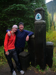

